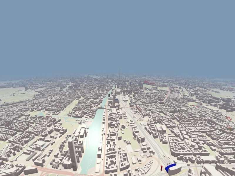
OSM Buildings
A 3D building viewer of OSM (OpenStreetMap) buildings map data.
Overview
This application demonstrates how to create 3D building geometry for display on a map using data from OpenStreetMap (OSM) servers or a locally limited data set when the server is unavailable.
Queue handling
The application uses a queue to handle concurrent requests to boost up the loading process of maps and building data.
OSMRequest::OSMRequest(QObject *parent)
    : QObject{parent}
{
    connect( &m_queuesTimer, &QTimer::timeout, this, [this](){
        if ( m_buildingsQueue.isEmpty() && m_mapsQueue.isEmpty() ) {
            m_queuesTimer.stop();
        }
        else {

#ifdef QT_DEBUG
            const int numConcurrentRequests = 1;
#else
            const int numConcurrentRequests = 6;
#endif
            if ( !m_buildingsQueue.isEmpty() && m_buildingsNumberOfRequestsInFlight < numConcurrentRequests ) {
                getBuildingsDataRequest(m_buildingsQueue.dequeue());
                ++m_buildingsNumberOfRequestsInFlight;
            }

            if ( !m_mapsQueue.isEmpty() && m_mapsNumberOfRequestsInFlight < numConcurrentRequests ) {
                getMapsDataRequest(m_mapsQueue.dequeue());
                ++m_mapsNumberOfRequestsInFlight;
            }
        }
    });
    m_queuesTimer.setInterval(0);
Fetching and parsing data
A custom request handler class is implemented for fetching the data from the OSM building and map servers.
void OSMRequest::getBuildingsData(const QQueue<OSMTileData> &buildingsQueue) {

    if ( buildingsQueue.isEmpty() )
        return;
    m_buildingsQueue = buildingsQueue;
    if ( !m_queuesTimer.isActive() )
        m_queuesTimer.start();
}

void OSMRequest::getBuildingsDataRequest(const OSMTileData &tile)
{
    const QString fileName = "data/"_L1 + tileKey(tile) + ".json"_L1;
    QFileInfo file(fileName);
    if ( file.size() > 0 ) {
        QFile file(fileName);
        if (file.open(QFile::ReadOnly)){
            QByteArray data = file.readAll();
            file.close();
            emit buildingsDataReady( importGeoJson(QJsonDocument::fromJson( data )), tile.TileX, tile.TileY, tile.ZoomLevel );
            --m_buildingsNumberOfRequestsInFlight;
            return;
        }
    }

    QUrl url = QUrl(QString(URL_OSMB_JSON).arg(QString::number(tile.ZoomLevel),
                                               QString::number(tile.TileX),
                                               QString::number(tile.TileY),
                                               m_token));
    QNetworkReply * reply = m_networkAccessManager.get( QNetworkRequest(url));
    connect( reply, &QNetworkReply::finished, this, [this, reply, tile](){
        reply->deleteLater();
        if ( reply->error() == QNetworkReply::NoError ) {
            QByteArray data = reply->readAll();
            emit buildingsDataReady( importGeoJson(QJsonDocument::fromJson( data )), tile.TileX, tile.TileY, tile.ZoomLevel );
        } else {
            const QByteArray message = reply->readAll();
            static QByteArray lastMessage;
            if (message != lastMessage) {
                lastMessage = message;
                qWarning().noquote() << "OSMRequest::getBuildingsData " << reply->error()
                                     << reply->url() << message;
            }
        }
        --m_buildingsNumberOfRequestsInFlight;
    } );
void OSMRequest::getMapsData(const QQueue<OSMTileData> &mapsQueue) {

    if ( mapsQueue.isEmpty() )
        return;
    m_mapsQueue = mapsQueue;
    if ( !m_queuesTimer.isActive() )
        m_queuesTimer.start();
}

void OSMRequest::getMapsDataRequest(const OSMTileData &tile)
{
    const QString fileName = "data/"_L1 + tileKey(tile) + ".png"_L1;
    QFileInfo file(fileName);
    if ( file.size() > 0) {
        QFile file(fileName);
        if (file.open(QFile::ReadOnly)){
            QByteArray data = file.readAll();
            file.close();
            emit mapsDataReady(  data, tile.TileX, tile.TileY, tile.ZoomLevel );
            --m_mapsNumberOfRequestsInFlight;
            return;
        }
    }

    QUrl url = QUrl(QString(URL_OSMB_MAP).arg(QString::number(tile.ZoomLevel),
                                              QString::number(tile.TileX),
                                              QString::number(tile.TileY)));
    QNetworkReply * reply = m_networkAccessManager.get( QNetworkRequest(url));
    connect( reply, &QNetworkReply::finished, this, [this, reply, tile](){
        reply->deleteLater();
        if ( reply->error() == QNetworkReply::NoError ) {
            QByteArray data = reply->readAll();
            emit mapsDataReady( data, tile.TileX, tile.TileY, tile.ZoomLevel );
        } else {
            const QByteArray message = reply->readAll();
            static QByteArray lastMessage;
            if (message != lastMessage) {
                lastMessage = message;
                qWarning().noquote() << "OSMRequest::getMapsDataRequest" << reply->error()
                                     << reply->url() << message;
            }
        }
        --m_mapsNumberOfRequestsInFlight;
    } );
The application parses the online data to convert it to a QVariant list of keys and values in geo formats such as QGeoPolygon.
            emit buildingsDataReady( importGeoJson(QJsonDocument::fromJson( data )), tile.TileX, tile.TileY, tile.ZoomLevel );
            --m_buildingsNumberOfRequestsInFlight;
The parsed building data is sent to a custom geometry item to convert the geo coordinates to 3D coordinates.
    constexpr auto convertGeoCoordToVertexPosition = [](const float lat, const float lon) -> QVector3D {

        const double scale = 1.212;
        const double geoToPositionScale = 1000000 * scale;
        const double XOffsetFromCenter = 537277 * scale;
        const double YOffsetFromCenter = 327957 * scale;
        double x = (lon/360.0 + 0.5) * geoToPositionScale;
        double y = (1.0-log(qTan(qDegreesToRadians(lat)) + 1.0 / qCos(qDegreesToRadians(lat))) / M_PI) * 0.5 * geoToPositionScale;
        return QVector3D( x - XOffsetFromCenter, YOffsetFromCenter - y, 0.0 );
    };
The required data for the index and vertex buffers, such as position, normals, tangents, and UV coordinates, is generated.
    for ( const QVariant &baseData : geoVariantsList ) {
        for ( const QVariant &dataValue : baseData.toMap()["data"_L1].toList() ) {
            const auto featureMap = dataValue.toMap();
            const auto properties = featureMap["properties"_L1].toMap();
            const auto buildingCoords = featureMap["data"_L1].value<QGeoPolygon>().perimeter();
            float height = 0.15 * properties["height"_L1].toLongLong();
            float levels = static_cast<float>(properties["levels"_L1].toLongLong());
            QColor color = QColor::fromString( properties["color"_L1].toString());
            if ( !color.isValid() || color == QColor(Qt::GlobalColor::black))
                color = QColor(Qt::GlobalColor::white);
            QColor roofColor = QColor::fromString( properties["roofColor"_L1].toString());
            if ( !roofColor.isValid() || roofColor == QColor(Qt::GlobalColor::black) )
                roofColor = color;

            QVector3D subsetMinBound = QVector3D(maxFloat, maxFloat, maxFloat);
            QVector3D subsetMaxBound = QVector3D(minFloat, minFloat, minFloat);

            qsizetype numSubsetVertices = buildingCoords.size() * 2;
            qsizetype lastVertexDataCount = vertexData.size();
            qsizetype lastIndexDataCount = indexData.size();
            vertexData.resize( lastVertexDataCount + numSubsetVertices * strideVertex );
            indexData.resize( lastIndexDataCount + ( numSubsetVertices - 2 ) * stridePrimitive );

            float *vbPtr = &reinterpret_cast<float *>(vertexData.data())[globalVertexCounter * strideVertexLen];
            uint32_t *ibPtr = &reinterpret_cast<uint32_t *>(indexData.data())[globalPrimitiveCounter * 3];

            qsizetype subsetVertexCounter = 0;

            QVector3D lastBaseVertexPos;
            QVector3D lastExtrudedVertexPos;
            QVector3D currentBaseVertexPos;
            QVector3D currentExtrudedVertexPos;
            QVector3D subsetPolygonCenter;

            using PolygonVertex = std::array<double, 2>;
            using PolygonVertices = std::vector<PolygonVertex>;

            PolygonVertices roofPolygonVertices;

            for ( const QGeoCoordinate &buildingPoint : buildingCoords ) {
   ...
                    std::vector<PolygonVertices> roofPolygonsVertices;
                    roofPolygonsVertices.push_back( roofPolygonVertices );
                    std::vector<uint32_t> roofIndices = mapbox::earcut<uint32_t>(roofPolygonsVertices);

                    lastVertexDataCount = vertexData.size();
                    lastIndexDataCount = indexData.size();
                    vertexData.resize( lastVertexDataCount + roofPolygonVertices.size() * strideVertex );
                    indexData.resize( lastIndexDataCount + roofIndices.size() * sizeof(uint32_t) );

                    vbPtr = &reinterpret_cast<float *>(vertexData.data())[globalVertexCounter * strideVertexLen];
                    ibPtr = &reinterpret_cast<uint32_t *>(indexData.data())[globalPrimitiveCounter * 3];

                    for ( const uint32_t &roofIndex : roofIndices ) {
                        *ibPtr++ = roofIndex + globalVertexCounter;
                    }
                    qsizetype roofPrimitiveCount = roofIndices.size() / 3;
                    globalPrimitiveCounter += roofPrimitiveCount;

                    for ( const PolygonVertex &polygonVertex : roofPolygonVertices ) {

                        //position
                        *vbPtr++ = polygonVertex.at(0);
                        *vbPtr++ = polygonVertex.at(1);
                        *vbPtr++ = height;

                        //normal
                        *vbPtr++ = 0.0;
                        *vbPtr++ = 0.0;
                        *vbPtr++ = 1.0;

                        //tangent
                        *vbPtr++ = 1.0;
                        *vbPtr++ = 0.0;
                        *vbPtr++ = 0.0;

                        //binormal
                        *vbPtr++ = 0.0;
                        *vbPtr++ = 1.0;
                        *vbPtr++ = 0.0;

                        //color/
                        *vbPtr++ = roofColor.redF();
                        *vbPtr++ = roofColor.greenF();
                        *vbPtr++ = roofColor.blueF();
                        *vbPtr++ = 1.0;

                        //texcoord
                        *vbPtr++ = 1.0;
                        *vbPtr++ = 1.0;

                        *vbPtr++ = 0.0;
                        *vbPtr++ = 1.0;

                        ++subsetVertexCounter;
                        ++globalVertexCounter;
                    }

                }

            }
        }
    }

    clear();
The downloaded PNG data is sent to a custom QQuick3DTextureData item to convert the PNG format to a texture for map tiles.
void CustomTextureData::setImageData(const QByteArray &data)
{
    QImage image = QImage::fromData(data).convertToFormat(QImage::Format_RGBA8888);
    setTextureData( QByteArray(reinterpret_cast<const char*>(image.constBits()), image.sizeInBytes()) );
    setSize( image.size() );
    setHasTransparency(false);
    setFormat(Format::RGBA8);
}
The application uses camera position, orientation, zoom level, and tilt to find the nearest tiles in the view.
void OSMManager::setCameraProperties(const QVector3D &position, const QVector3D &right,
                                    float cameraZoom, float minimumZoom, float maximumZoom,
                                    float cameraTilt, float minimumTilt, float maximumTilt)
{

    float tiltFactor = (cameraTilt - minimumTilt) / qMax(maximumTilt - minimumTilt, 1.0);
    float zoomFactor = (cameraZoom - minimumZoom) / qMax(maximumZoom - minimumZoom, 1.0);

    // Forward vector align to the XY plane
    QVector3D forwardVector = QVector3D::crossProduct(right,
                                                      QVector3D(0.0, 0.0, -1.0)).normalized();
    QVector3D projectionOfForwardOnXY = position
            + forwardVector * tiltFactor * zoomFactor * 50.0;

    QQueue<OSMTileData> queue;
    for ( int forwardIndex = -20; forwardIndex <= 20; ++forwardIndex ){
        for ( int sidewardIndex = -20; sidewardIndex <= 20; ++sidewardIndex ){
            QVector3D transferredPosition = projectionOfForwardOnXY
                      + QVector3D(float(m_tileSizeX * sidewardIndex), float(m_tileSizeY * forwardIndex), 0.0);
            addBuildingRequestToQueue(queue, m_startBuildingTileX + int(transferredPosition.x() / m_tileSizeX),
                                m_startBuildingTileY - int(transferredPosition.y() / m_tileSizeY));
        }
    }

    const QPoint projectedTile{m_startBuildingTileX + int(projectionOfForwardOnXY.x() / m_tileSizeX),
                               m_startBuildingTileY - int(projectionOfForwardOnXY.y() / m_tileSizeY)};

    auto closer = [projectedTile](const OSMTileData &v1, const OSMTileData &v2) -> bool {
        return v1.distanceTo(projectedTile) < v2.distanceTo(projectedTile);
    };
    std::sort(queue.begin(), queue.end(), closer);

    m_request->getBuildingsData( queue );
    m_request->getMapsData( queue );
Generates the tiles request queue.
void OSMManager::addBuildingRequestToQueue(QQueue<OSMTileData> &queue, int tileX, int tileY, int zoomLevel)
{
    OSMTileData data{tileX, tileY, zoomLevel};
Controls
When you run the application, use the following controls for navigation.
| Windows | Android | |
|---|---|---|
| Pan | Left mouse button + drag | Drag |
| Zoom | Mouse wheel | Pinch |
| Rotate | Right mouse button + drag | n/a |
        OSMCameraController {
            id: cameraController
            origin: originNode
            camera: cameraNode
        }
Rendering
Every chunk of the map tile consists of a QML model (the 3D geometry) and a custom material which uses a rectangle as a base to render the tilemap texture.
        ...
        id: chunkModelMap
        Node {
            id: node
            property variant mapData: null
            property int tileX: 0
            property int tileY: 0
            property int zoomLevel: 0
            Model {
                id: basePlane
                position: Qt.vector3d( osmManager.tileSizeX * node.tileX, osmManager.tileSizeY * -node.tileY, 0.0 )
                scale: Qt.vector3d( osmManager.tileSizeX / 100., osmManager.tileSizeY / 100., 0.5)
                source: "#Rectangle"
                materials: [
                    CustomMaterial {
                        property TextureInput tileTexture: TextureInput {
                            enabled: true
                            texture: Texture {
                                textureData: CustomTextureData {
                                    Component.onCompleted: setImageData( node.mapData )
                                } }
                        }
                        shadingMode: CustomMaterial.Shaded
                        cullMode: Material.BackFaceCulling
                        fragmentShader: "customshadertiles.frag"
                    }
                ]
            }
The application uses custom geometry to render tile buildings.
        ...
        id: chunkModelBuilding
        Node {
            id: node
            property variant geoVariantsList: null
            property int tileX: 0
            property int tileY: 0
            property int zoomLevel: 0
            Model {
                id: model
                scale: Qt.vector3d(1, 1, 1)

                OSMGeometry {
                    id: osmGeometry
                    Component.onCompleted: updateData( node.geoVariantsList )
                    onGeometryReady:{
                        model.geometry = osmGeometry
                    }
                }
                materials: [

                    CustomMaterial {
                        shadingMode: CustomMaterial.Shaded
                        cullMode: Material.BackFaceCulling
                        vertexShader: "customshaderbuildings.vert"
                        fragmentShader: "customshaderbuildings.frag"
                    }
                ]
            }
To render building parts such as rooftops with one draw call, a custom shader is used.
// SPDX-License-Identifier: LicenseRef-Qt-Commercial OR BSD-3-Clause

VARYING vec4 color;

float rectangle(vec2 samplePosition, vec2 halfSize) {
    vec2 componentWiseEdgeDistance = abs(samplePosition) - halfSize;
    float outsideDistance = length(max(componentWiseEdgeDistance, 0.0));
    float insideDistance = min(max(componentWiseEdgeDistance.x, componentWiseEdgeDistance.y), 0.0);
    return outsideDistance + insideDistance;
}

void MAIN() {
    vec2 tc = UV0;
    vec2 uv = fract(tc * UV1.x); //UV1.x number of levels
    uv = uv * 2.0 - 1.0;
    uv.x = 0.0;
    uv.y = smoothstep(0.0, 0.2, rectangle( vec2(uv.x, uv.y + 0.5), vec2(0.2)) );
    BASE_COLOR = vec4(color.xyz * mix( clamp( ( vec3( 0.4, 0.4, 0.4 ) + tc.y)
                                             * ( vec3( 0.6, 0.6, 0.6 ) + uv.y)
                                             , 0.0, 1.0), vec3(1.0), UV1.y ), 1.0); // UV1.y as is roofTop
    ROUGHNESS = 0.3;
    METALNESS = 0.0;
    FRESNEL_POWER = 1.0;
}
Running the Example
To run the example from Qt Creator, open the Welcome mode and select the example from Examples. For more information, see Qt Creator: Tutorial: Build and run.
See also QML Applications.
© 2026 The Qt Company Ltd. Documentation contributions included herein are the copyrights of their respective owners. The documentation provided herein is licensed under the terms of the GNU Free Documentation License version 1.3 as published by the Free Software Foundation. Qt and respective logos are trademarks of The Qt Company Ltd. in Finland and/or other countries worldwide. All other trademarks are property of their respective owners.
