最小地图(QML)
使用Qt Quick 显示地图的最少代码。
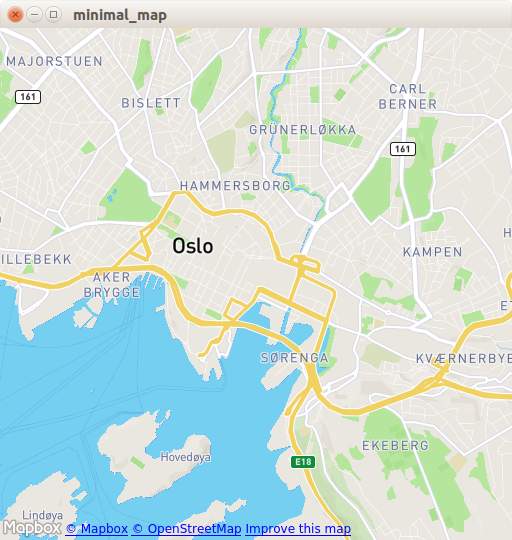
最小地图演示了如何使用Map 项目渲染地图。它显示了显示地图所需的最少代码量,可作为进一步实验的基础。
运行示例
要从 Qt Creator,打开Welcome 模式并从Examples 中选择示例。更多信息,请参阅Qt Creator: 教程:构建并运行。
C++ 代码
在main.cpp 中,我们只使用QGuiApplication 和QQmlApplicationEngine 类。
#include <QGuiApplication>
#include <QQmlApplicationEngine>
在主函数中,我们首先实例化一个QGuiApplication 对象。然后,我们创建一个QQmlApplicationEngine ,并告诉它从Qt XML 资源系统中加载main.qml 。
最后,QGuiApplication::exec() 启动主事件循环。
int main(int argc, char *argv[])
{
    QGuiApplication app(argc, argv);

    QQmlApplicationEngine engine;
    engine.load(QUrl(QStringLiteral("qrc:/main.qml")));

    return app.exec();
}
QML 代码
在main.qml 中,我们导入QtLocation QML 模块及其依赖的QtPositioning QML 模块。接下来,我们创建顶层窗口,设置合理的默认大小,并使其可见。窗口将由显示地图的Map 项目填充。
import QtQuick
import QtLocation
import QtPositioning

Window {
    width: Qt.platform.os == "android" ? Screen.width : 512
    height: Qt.platform.os == "android" ? Screen.height : 512
    visible: true
    title: map.center + " zoom " + map.zoomLevel.toFixed(3)
           + " min " + map.minimumZoomLevel + " max " + map.maximumZoomLevel

    Plugin {
        id: mapPlugin
        name: "osm"
    }

    Map {
        id: map
        anchors.fill: parent
        plugin: mapPlugin
        center: QtPositioning.coordinate(59.91, 10.75) // Oslo
        zoomLevel: 14
        property geoCoordinate startCentroid

        PinchHandler {
            id: pinch
            target: null
            onActiveChanged: if (active) {
                map.startCentroid = map.toCoordinate(pinch.centroid.position, false)
            }
            onScaleChanged: (delta) => {
                map.zoomLevel += Math.log2(delta)
                map.alignCoordinateToPoint(map.startCentroid, pinch.centroid.position)
            }
            onRotationChanged: (delta) => {
                map.bearing -= delta
                map.alignCoordinateToPoint(map.startCentroid, pinch.centroid.position)
            }
            grabPermissions: PointerHandler.TakeOverForbidden
        }
        WheelHandler {
            id: wheel
            // workaround for QTBUG-87646 / QTBUG-112394 / QTBUG-112432:
            // Magic Mouse pretends to be a trackpad but doesn't work with PinchHandler
            // and we don't yet distinguish mice and trackpads on Wayland either
            acceptedDevices: Qt.platform.pluginName === "cocoa" || Qt.platform.pluginName === "wayland"
                             ? PointerDevice.Mouse | PointerDevice.TouchPad
                             : PointerDevice.Mouse
            rotationScale: 1/120
            property: "zoomLevel"
        }
        DragHandler {
            id: drag
            target: null
            onTranslationChanged: (delta) => map.pan(-delta.x, -delta.y)
        }
        Shortcut {
            enabled: map.zoomLevel < map.maximumZoomLevel
            sequence: StandardKey.ZoomIn
            onActivated: map.zoomLevel = Math.round(map.zoomLevel + 1)
        }
        Shortcut {
            enabled: map.zoomLevel > map.minimumZoomLevel
            sequence: StandardKey.ZoomOut
            onActivated: map.zoomLevel = Math.round(map.zoomLevel - 1)
        }
    }
}
Plugin 项是定义我们要使用的地图提供程序所必需的。该示例可与任何可用的地理服务插件配合使用。不过,有些插件可能需要额外的插件参数才能正常运行,我们可以使用PluginParameter 来指定这些参数。在本例中,我们使用osm 插件,它是Qt Location 开放式街道地图插件,不需要任何参数。
在Map 项中,我们引用了我们使用的plugin ,并设置了地图的center 和zoomLevel 。
要求
该示例需要正常的互联网连接,以下载OpenStreetMap 地图砖。可选的系统代理会自动下载。
© 2026 The Qt Company Ltd. Documentation contributions included herein are the copyrights of their respective owners. The documentation provided herein is licensed under the terms of the GNU Free Documentation License version 1.3 as published by the Free Software Foundation. Qt and respective logos are trademarks of The Qt Company Ltd. in Finland and/or other countries worldwide. All other trademarks are property of their respective owners.
